How Directional Drilling Works in El Paso Ground
The mountain writes the ground map
The Franklin Mountains organize the metro's geology like they organize its streets. Off their flanks spread coarse alluvial fans — gravels and cobbles stiffened with caliche across the east and west mesas, fast-draining ground that drills quickly between the reaches where cemented layers price like the rock they are and cobble runs test a pilot's manners. Along the river, the valley substitutes irrigated loams and clays over shallow groundwater — softer drilling with wetter pits and closer neighbors underground.
Near the mountain itself, bedrock is not a rumor: the range's limestone and igneous rock reach the surface, and bench alignments on either side can meet it where the fans thin. The honest quote names which of these grounds — fan, valley, or mountain-edge — your alignment lives in, and prices the footage classes separately when it lives in more than one.
Drilling next to an international boundary
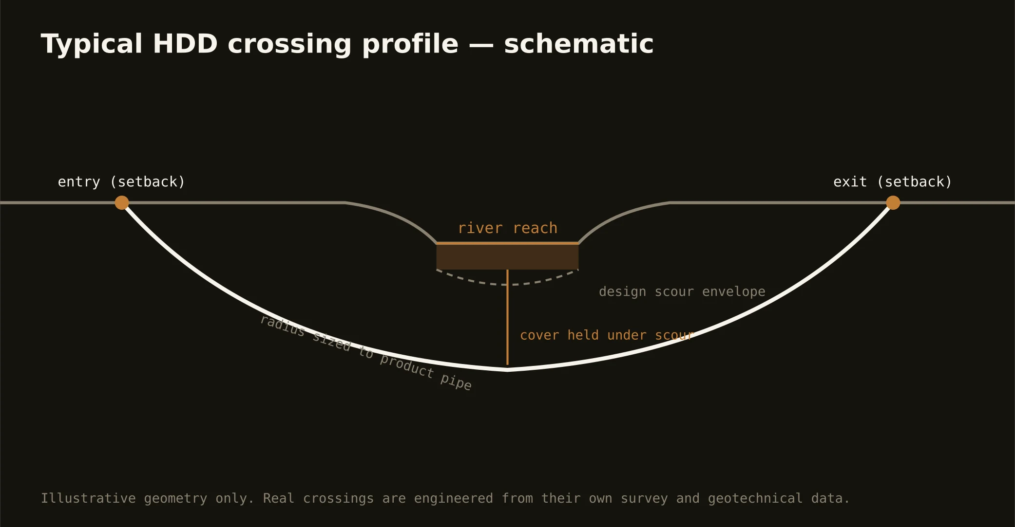
The river corridor concentrates the metro's distinctive paperwork. The channelized Rio Grande, its levees, and adjacent federal lands sit under the binational boundary-water authority's administration; the Rio Grande Project's canals and drains sit under the irrigation district's permits and delivery calendar; and the roads and rail lines that shadow the river add their own owners. Corridor crossings are therefore authority-stack projects: the license and permit processes are the schedule's spine, and the technical bore — honest alluvium under an engineered section — is often the easy half.
The sequence, borderland edition
Standard bones: 811 locates plus private designating, potholes on every crossing utility — with special respect for the valley's irrigation-era infrastructure — pilot bore on profile, reaming to roughly one and a half times product, pullback, restoration. Borderland bends: cobble and caliche tooling staged on mesa work, dewatered pits on valley work, containment-forward fluid programs anywhere near the river system, and summer heat protocols that move real work to the edges of the day.
Who owns what you're crossing
City streets carry the city's ROW permit; county roads carry the county's process, out to the Hudspeth flats. The state system — I-10, Loop 375, the highways east — runs on TxDOT's utility-installation permitting under the accommodation rules. The river corridor runs on the boundary-water authority's license; the canals and drains on the irrigation district's permits and calendar; the rail spines on the railroads' own processes; base-adjacent work on the installation's coordination. The quote names every owner on your alignment, because in this metro the owners are the map.
Straight answers
Will you hit caliche or cobbles?
On the mesas, plan for one or both — the fans nearly guarantee it, and our quotes state the assumption with tooling staged. In the valley the question flips to water: shallow groundwater near the channels shapes the pit and fluid plan instead. Either way, the ground gets named before it gets drilled.
How deep do bores run under El Paso streets?
Cover follows the owning authority's standard and sits below everything potholed on the alignment; river-corridor and canal crossings run to the administering authority's engineered criteria. The bore plan states your number before mobilization.
Does the border itself change a utility bore?
The boundary is the river's centerline, and civilian utility crossings of the corridor stop at the authority stack on the U.S. side — the license process, the levees, the canals. What the border changes is coordination density: more agencies per foot than any other crossing in Texas, which is exactly why the permit scope leads our river-corridor quotes.
Ready to put a number on a real crossing? Send the scope — a person prices it.